More actions
| Geografika | |
|---|---|
 | |
| General | |
| Author | Morgan Robertson (morganDS) |
| Type | Trivia |
| Version | Full |
| License | Mixed |
| Last Updated | 2008/02/09 |
| Links | |
| Download | |
| Website | |
| Source | |
Geografika is a geography quiz-game for the Nintendo DS.
It was submitted to the NEO Summer Coding Compo 2008 (NDS Game).
Features
- 300 questions over:
- Locations of cities and countries.
- Monuments and physical features.
- Capitals and landlocked countries.
- Borders, areas and maps.
- Adventure mode.
- Quiz mode.
- Library.
- Save system.
User guide
Game modes
The goal of Adventure mode is to progress from city to city, where each quiz will get more and more difficult. You must receive at least 80% to travel to the next city. If you score above 90% on a quiz in Adventure mode, you will unlock contents in the Library.
Library will allow you to view photos, maps, and information on places and countries around the world. Unlock more countries and places by earning an A on quizzes in adventure mode. Select the Map option in the library to view a fully scrollable, simplified world map.
Quiz mode is where you can take a quiz with 20 random questions.
Automatic saving
If you are using a card compatible with the FAT file system, your progress will be automatically saved after each quiz in adventure mode.
If Geografika is not saving data after you power off the DS, try patching the file.
Controls
Stylus - Navigate menus, Select answer
A - Select menu option
B - Go back to previous menu
L/R - Change text color
D-Pad - Move the map (library)
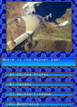
Screenshots
Media
Geografika for Nintendo DS (Morgan Robertson)
Compatibility
Does not work on emulators.
Changelog
v1.0
- Initially released in the forums at palib.info (geografika.nds only) on February 9, 2008 (later released at http://robertson.heliohost.org and http://www.ndshb.com).
Credits
Programmed by Morgan Robertson.
Graphics by Morgan Robertson.
Photos and maps obtained from http://wikipedia.org and edited by Morgan Robertson.
Information adapted from The Kingfisher Young People's Atlas of the World (Scholastic Publishing, copyright 1997) and http://wikipedia.org.
Special Thanks To:
- Mollusk and everyone at PAlib for writing a great library and other resources.
- Everyone who offered help and support in the PAlib forums.
- Everyone at devkitPro.
External links
- Author's website - http://robertson.heliohost.org (archived)
- Google Code - http://code.google.com/p/geografika
- NeoFlash - https://www.neoflash.com/forum/index.php?topic=5279.0 (archived)
- PAlib - http://palib.info/forum/modules/newbb/viewtopic.php?topic_id=4229&forum=9